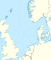
File:North Sea relief location map.jpg
外观

本预览的尺寸:511 × 599像素。 其他分辨率:205 × 240像素 | 409 × 480像素 | 988 × 1,159像素。
原始文件 (988 × 1,159像素,文件大小:909 KB,MIME类型:image/jpeg)
文件历史
点击某个日期/时间查看对应时刻的文件。
| 日期/时间 | 缩略图 | 大小 | 用户 | 备注 | |
|---|---|---|---|---|---|
| 当前 | 2010年6月18日 (五) 19:11 |  | 988 × 1,159(909 KB) | Uwe Dedering | {{Information |Description={{de|Positionskarte der Nordsee}} Quadratische Plattkarte, N-S-Streckung 180 %. Geographische Begrenzung der Karte: * N: 62.5° N * S: 50.5° N * W: 5.2° W * O: 13.2° O {{en|Location map of the [[:en:North Sea| |
文件用途
以下2个页面使用本文件:
全域文件用途
以下其他wiki使用此文件:
- ar.wikipedia.org上的用途
- ast.wikipedia.org上的用途
- az.wikipedia.org上的用途
- be.wikipedia.org上的用途
- ca.wikipedia.org上的用途
- ceb.wikipedia.org上的用途
- cs.wikipedia.org上的用途
- da.wikipedia.org上的用途
- de.wikipedia.org上的用途
- de.wikivoyage.org上的用途
- en.wikipedia.org上的用途
- Battle of Sluys
- Piper Alpha
- Brae oilfield
- Ekofisk oil field
- Statfjord oil field
- Gullfaks oil field
- Oseberg oil field
- Snorre oil field
- Troll gas field
- Heligoland Bight
- Piper oilfield
- Buchan Oil Field
- Battle of Zutphen
- Auk oilfield
- Dunlin oilfield
- Cormorant oilfield
- Eider oilfield
- Fulmar Oil Field
- Siege of Breda (1624)
- Tern oilfield
- Clair oilfield
- Mittelplate
- Valhall oil field
- SS Mount Ida
查看此文件的更多全域用途。


