
File:Nepe whitebird battlefield 20060804104614.JPG

預覽大小:800 × 600 像素。 其他解析度:320 × 240 像素 | 640 × 480 像素 | 1,024 × 768 像素 | 1,280 × 960 像素 | 2,048 × 1,536 像素。
原始檔案 (2,048 × 1,536 像素,檔案大小:656 KB,MIME 類型:image/jpeg)
| 描述 |
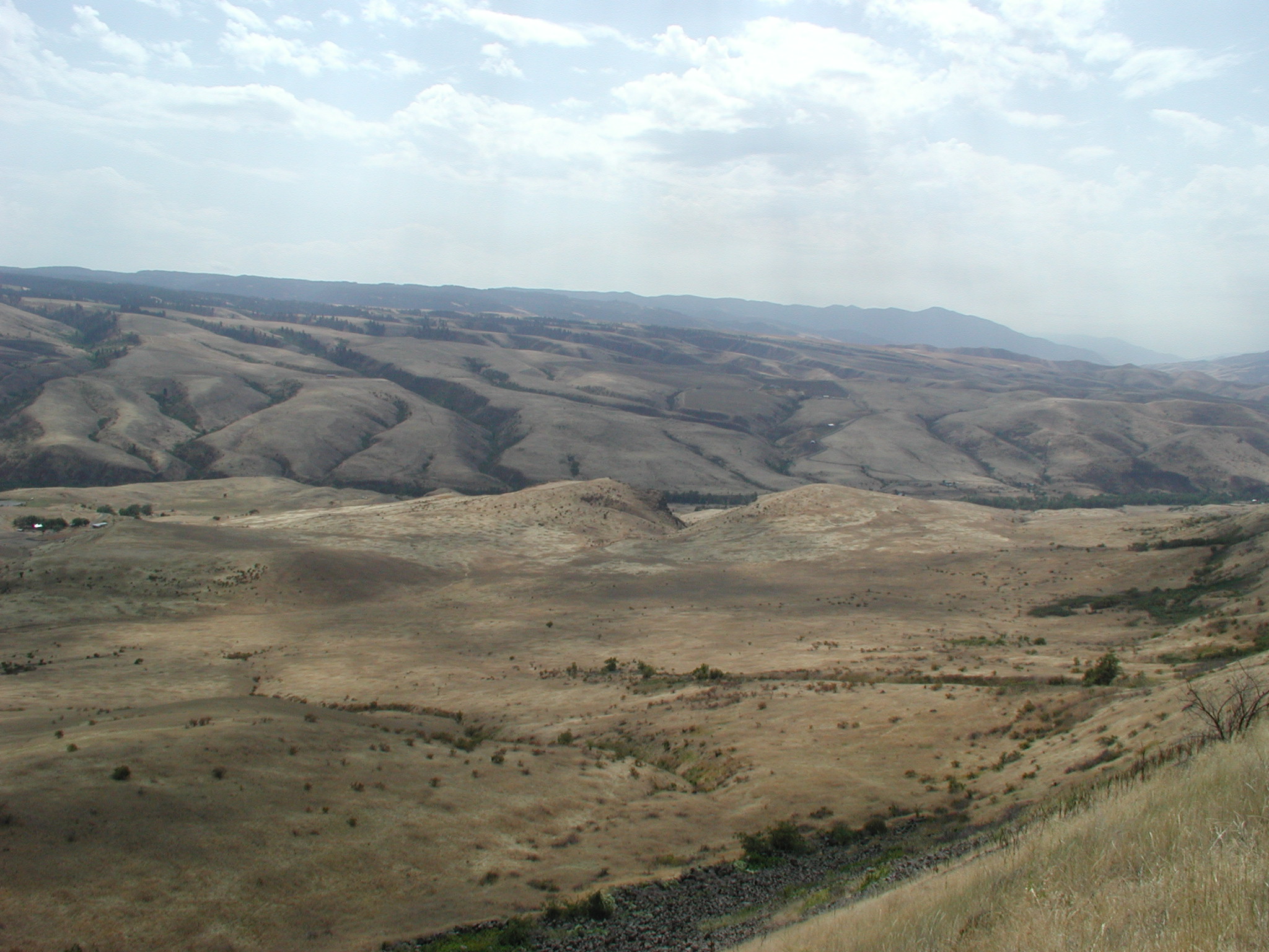
Whitebird Canyon Battlefield, Idaho, USA. This is where the first battle of the 1877 Nez Percé war took place. The Nez Percé defeated the U.S. Army. Whitebird Canyon as the soldiers saw it approaching from the North. The Nez Perce encampment was along White Bird Creek, the tree line running left to right across the center of the photo. The soldiers established defense lines on the right hand knoll in the center and retreated up the ridge from which this photo is taken. White Bird Creek entered the Salmon River just off the right side of the photo. |
|||
| 日期 | ||||
| 來源 | http://www.nps.gov/nepe//images/20060804104614.JPG | |||
| 作者 | NPS photo | |||
| 授權許可 (重用此檔案) |
|
檔案歷史
點選日期/時間以檢視該時間的檔案版本。
| 日期/時間 | 縮圖 | 尺寸 | 使用者 | 備註 | |
|---|---|---|---|---|---|
| 目前 | 2011年10月10日 (一) 13:25 | | 2,048 × 1,536(656 KB) | H-stt | {{Information |Description= Whitebird battlefield, Idaho, USA. This is where the first scirmish of the 1877 Nez Percé war took place when Nez Percé warriers won a battle against the US army |Source= http://www.nps.gov/nepe//images/20060804104614.JPG |Da |
檔案用途
下列頁面有用到此檔案:
全域檔案使用狀況
以下其他 wiki 使用了這個檔案:
- de.wikipedia.org 的使用狀況
- en.wikipedia.org 的使用狀況
- fr.wikipedia.org 的使用狀況
- ru.wikipedia.org 的使用狀況