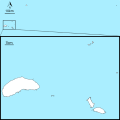
File:Map of Okinawa Prefecture with administrative division lines.svg
外观

此SVG文件的PNG预览的大小:800 × 480像素。 其他分辨率:320 × 192像素 | 1,024 × 614像素 | 1,280 × 768像素 | 2,560 × 1,536像素。
原始文件 (SVG文件,尺寸为1,000 × 600像素,文件大小:1.52 MB)
文件历史
点击某个日期/时间查看对应时刻的文件。
| 日期/时间 | 缩略图 | 大小 | 用户 | 备注 | |
|---|---|---|---|---|---|
| 当前 | 2021年10月2日 (六) 08:48 |  | 1,000 × 600(1.52 MB) | Kugel~commonswiki | == {{int:filedesc}} == {{Information |Description={{en|Map of Okinawa Prefecture with administrative division lines}} {{ja|日本・沖縄県の全域地図。点線は市町村の境界線。}} |Source=Using File:Japan location map.svg(GFDL or CC-BY-SA-3.0), and the orientation symbol File:North Pointer.svg(PD) {{en|Created based on the map of Geospatial Information Authority of Japan ([http://maps.gsi.go.jp/ Link])}} {{ja|国土地理院の地理院地図を基に作成}} |Date=2021-10-02 |Author={{own}} |Permission= |other_versions=<gallery> File:Map of Ok... |
文件用途
以下2个页面使用本文件:
全域文件用途
以下其他wiki使用此文件:
- ja.wikipedia.org上的用途


