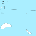
File:Map of Okinawa Island 02.svg
外觀

此 SVG 檔案的 PNG 預覽的大小:450 × 600 像素。 其他解析度:180 × 240 像素 | 360 × 480 像素 | 576 × 768 像素 | 768 × 1,024 像素 | 1,536 × 2,048 像素 | 750 × 1,000 像素。
原始檔案 (SVG 檔案,表面大小:750 × 1,000 像素,檔案大小:292 KB)
檔案歷史
點選日期/時間以檢視該時間的檔案版本。
| 日期/時間 | 縮圖 | 尺寸 | 用戶 | 備註 | |
|---|---|---|---|---|---|
| 目前 | 2021年10月2日 (六) 07:26 |  | 750 × 1,000(292 KB) | Kugel~commonswiki | Changed administrave division lines |
| 2017年7月5日 (三) 02:48 |  | 750 × 1,000(294 KB) | Kugel~commonswiki | modified scale position | |
| 2017年7月5日 (三) 01:10 |  | 750 × 1,000(294 KB) | Kugel~commonswiki | Added administrative lines and changed them to dotted, removed frame, modified font to sans-serif. | |
| 2017年4月7日 (五) 10:12 |  | 750 × 1,000(287 KB) | Kugel~commonswiki | {{Information |Description={{en|Map of Okinawa Island. Added boundaries of the municipalities of Okinawa Prefecture.}} {{ja|沖縄本島の地図}} |Source=Using the orientation symbol File:North Pointer.svg(PD) {{en|Created based on the map of Ge... |
檔案用途
下列2個頁面有用到此檔案:
全域檔案使用狀況
以下其他 wiki 使用了這個檔案:
- fr.wikipedia.org 的使用狀況
- Université des Ryūkyū
- Aquarium Churaumi d'Okinawa
- Château de Katsuren
- Château de Zakimi
- Shikina-en
- Seifa-utaki
- Château de Nakijin
- Château d'Urasoe
- Université Meiō
- Université préfectorale d'arts d'Okinawa
- Université préfectorale d'infirmières d'Okinawa
- Modèle:Géolocalisation/Île Okinawa
- Université internationale d'Okinawa
- Heiwa-dori
- Aéroport de Naha
- Camp Foster
- Musée d'histoire de Naha
- Exposition spécialisée de 1975
- Yontan Airfield
- Zoo et muséum d'Okinawa
- USS Bates (DE-68)
- USS Emmons (DD-457)
- USS Longshaw (DD-559)
- Aérodrome de l'île d'Yonaguni
- ja.wikipedia.org 的使用狀況
檢視此檔案的更多全域使用狀況。


