跳至內容

File:Atlas Van der Hagen-KW1049B13 057-BARBARIA.jpeg

頁面內容不支援其他語言。
這個檔案來自維基共享資源
維基百科,自由的百科全書

原始檔案(5,500 × 4,748 像素,檔案大小:3.23 MB,MIME 類型:image/jpeg


摘要

Dirk Jansz van Santen:​Atlas van Dirk van der Hagen (volledig, collectie KB)  wikidata:Q20754745 reasonator:Q20754745
作家
Dirk Jansz van Santen  (1636–1708) wikidata:Q19972007
 
別名
Dirk Jansz van Zanten; Dirk Janszoon van Santen; Dirk Jansen van Santen; Dirk Jansz. van Santen; Dirk Janz. van Santen; Dirck Jansz van Santen
描述 荷蘭畫家、​畫家、​afsetter以及着色家
出生/逝世日期 1637年 / 1636年 / 約 在維基數據編輯 1708年 在維基數據編輯
出生/逝世地點 阿姆斯特丹 阿姆斯特丹
作品年代 1680年 在維基數據編輯–1700年 在維基數據編輯
創作地點
阿姆斯特丹 (1652年–1708年); 巴黎 在維基數據編輯
權威檔案
 在維基數據編輯
image of artwork listed in title parameter on this page
作者
Publisher:
約翰內斯·揚松紐斯  (1588–1664)  wikidata:Q949492 s:it:Autore:Johannes Janssonius
 
別名
Jan Jansson, Jan Jansz, Jan Janszoon, Joannes Janssonius
描述 荷蘭製圖師、​出版商、​printseller以及視覺藝術家
出生/逝世日期 1588年 在維基數據編輯 1664年7月11日 / 1664年 在維基數據編輯
出生/逝世地點 安恆 阿姆斯特丹
作品年代 從1616年到1664年
date QS:P,+1650-00-00T00:00:00Z/7,P580,+1616-00-00T00:00:00Z/9,P582,+1664-00-00T00:00:00Z/9
創作地點
阿姆斯特丹 (1612年–1664年); 安恆 (1612年–1612年) 在維基數據編輯
權威檔案
creator QS:P170,Q949492
標題
BARBARIA
物體類型 地圖
object_type QS:P31,Q4006
描述
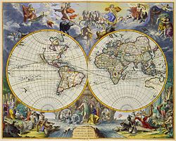
Nederlands: Op deze kaart van Jan Janssonius (1588-1664) is de kust van Noord-Afrika afgebeeld, een gebied dat in de 17de en 18de eeuw bekend stond als Barbarije. Het bovenste deel van het kaartblad toont een overzichtskaart van Noord-Afrika van de Nijldelta tot aan de Canarische Eilanden. Op het onderste deel zien we grote delen van het tegenwoordige Algerije, Tunesië en Libië.
English: This map by Jan Janssonius (1588-1664) shows the coast of North Africa, an area known in the 17th century as Barbaria. The upper part of the map represents a general map of North-Africa from the delta of the River Nile to the Canary Islands. The bottom part shows large areas of Algeria, Tunesia and Libya.
語言 荷蘭語 在維基數據編輯
日期 約1650年
date QS:P571,+1650-00-00T00:00:00Z/9,P1480,Q5727902
出版日期  在維基數據編輯
表現方法
Nederlands: kopergravure
English: 銅雕刻
尺寸 22 x 58 en 26 x 58 cm
institution QS:P195,Q1526131
登錄號
Description of the Atlas Van der Hagen in the catalogue of the KB: http://opc4.kb.nl/DB=1/TTL=1/LNG=EN/PPN?PPN=353012750
創作地點 Amsterdam
備註 KW1049B13_057 - Volume 1
Related persons
InfoField
Jan Janssonius
Depicted locations
InfoField
Africa - Egypt - Algeria - Tunesia - Libya
參考文獻
來源/攝影者

Source page at the Geheugen van Nederland / Memory of the Netherlands website.

授權許可
(重用此檔案)
此為如實地拍攝平面藝術品的相片複製本。原作位於公有領域,是因下列原因:
Public domain

本作品在其來源國以及其他版權期限是作者逝世後100年或以下的國家與地區屬於公有領域


你必須增加美國公有領域標籤顯示為何這個作品在美國屬於公有領域。
維基媒體基金會的官方立場認為:「針對平面公有領域的藝術作品進行忠實重製,其重製後的照片也屬於公有領域。」
因此,可認定本重製照片屬於公有領域。在其他司法管轄區,再利用此照片可能會被限制;參見再利用PD-Art照片以獲得進一步資訊。
其他版本

說明

添加單行說明來描述出檔案所代表的內容
17th-century map showing the Barbary Coast

在此檔案描寫的項目

描繪內容

巴巴裏海岸 繁體中文 (已轉換拼寫)

北部非洲 中文 (已轉換拼寫)

尼羅河三角洲 Chinese (Hong Kong) (已轉換拼寫)

突尼斯 Chinese (Hong Kong) (已轉換拼寫)

利比亞 Chinese (Hong Kong) (已轉換拼寫)

帆船 Chinese (Hong Kong) (已轉換拼寫)

槳帆船 Chinese (Hong Kong) (已轉換拼寫)

 繁體中文 (已轉換拼寫)

 繁體中文 (已轉換拼寫)

海軍作戰 簡體中文 (已轉換拼寫)

火炮 中文 (已轉換拼寫)

火山 Chinese (Hong Kong) (已轉換拼寫)

著作權狀態 繁體中文 (已轉換拼寫)

荷蘭皇家圖書館 中文 (已轉換拼寫)

主體角色 Chinese (Hong Kong) (已轉換拼寫):​collection highlight 英文

檔案來源 Chinese (Taiwan) (已轉換拼寫)

多媒體型式 繁體中文 (已轉換拼寫)

image/jpeg

數碼影像 Chinese (Hong Kong) (已轉換拼寫)

校驗和 繁體中文 (已轉換拼寫)

a957983c45901a5045e8cdc3cd4bdda9a0bd0414

斷定方法:​SHA-1 中文 (已轉換拼寫)

資料大小 Chinese (Hong Kong) (已轉換拼寫)

3,382,787 位元組

4,748 像素

5,500 像素

檔案歷史

點選日期/時間以檢視該時間的檔案版本。

日期/時間縮⁠圖尺寸用戶備⁠註
目前2015年7月17日 (五) 19:58於 2015年7月17日 (五) 19:58 版本的縮圖5,500 × 4,748(3.23 MB)OlafJanssenGWToolset: Creating mediafile for OlafJanssen.

下列頁面有用到此檔案:

全域檔案使用狀況

以下其他 wiki 使用了這個檔案:

詮釋資料