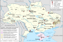
File:Map of Ukraine with Cities.png
外观

本预览的尺寸:800 × 538像素。 其他分辨率:320 × 215像素 | 640 × 430像素 | 1,024 × 688像素 | 1,280 × 860像素 | 2,560 × 1,720像素 | 4,844 × 3,255像素。
原始文件 (4,844 × 3,255像素,文件大小:2.72 MB,MIME类型:image/png)
文件历史
点击某个日期/时间查看对应时刻的文件。
| 日期/时间 | 缩略图 | 大小 | 用户 | 备注 | |
|---|---|---|---|---|---|
| 当前 | 2022年3月9日 (三) 12:34 |  | 4,844 × 3,255(2.72 MB) | Lencer | corr specification |
| 2022年3月6日 (日) 11:27 |  | 4,844 × 3,255(2.71 MB) | Lencer | + hatching | |
| 2022年3月3日 (四) 20:17 |  | 4,844 × 3,255(2.67 MB) | Lencer | == {{int:filedesc}} == {{Information |Description= {{en|Map of Ukraine, with Oblasts, largest cities, rivers and neighboring countries, as well as the disputed areas on the territory of Ukraine, "Republic of Crimea", "Luhansk People's Republic" and "Donetsk People's Republic"}} |Source=own work, used: * Ukraine_adm_location_map.svg by User:NordNordWest * Ukraine_2022-02-21.svg by User:NordNordWest... |
文件用途
以下页面使用本文件:
全域文件用途
以下其他wiki使用此文件:
- ar.wikipedia.org上的用途
- de.wikipedia.org上的用途
- en.wikipedia.org上的用途
- fi.wikipedia.org上的用途
- fr.wikipedia.org上的用途
- hy.wikipedia.org上的用途
- id.wikipedia.org上的用途
- ja.wikipedia.org上的用途
- ka.wikipedia.org上的用途
- kk.wikipedia.org上的用途
- km.wikipedia.org上的用途
- ko.wikipedia.org上的用途
- ku.wikipedia.org上的用途
- simple.wikipedia.org上的用途
- si.wikipedia.org上的用途
- sk.wikipedia.org上的用途
- sl.wikipedia.org上的用途
- ta.wikipedia.org上的用途
- tg.wikipedia.org上的用途
- th.wikipedia.org上的用途
- tr.wikipedia.org上的用途
- uk.wikipedia.org上的用途
- vi.wikipedia.org上的用途
- vls.wikipedia.org上的用途


