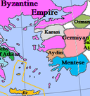
File:Anatolia1300.png
外观
Anatolia1300.png (535 × 330像素,文件大小:81 KB,MIME类型:image/png)
文件历史
点击某个日期/时间查看对应时刻的文件。
| 日期/时间 | 缩略图 | 大小 | 用户 | 备注 | |
|---|---|---|---|---|---|
| 当前 | 2017年1月20日 (五) 16:46 |  | 535 × 330(81 KB) | Cplakidas | fixing Dodecanese: Menteshe never controlled the offshore islands; they remained Byzantine until the Hospitallers or Genoese of Chios took them. |
| 2009年4月17日 (五) 22:26 |  | 535 × 330(64 KB) | Gabagool | Byzantine color lighter. New Armenia -> Little Armenia | |
| 2009年4月2日 (四) 19:12 |  | 535 × 330(64 KB) | Gabagool | added mamluks | |
| 2009年3月31日 (二) 16:36 |  | 535 × 330(63 KB) | Gabagool | {{Information |Description={{en|1=Map of the Anatolia region in AD 1300. (Partially based on Euratlas map of Europe, 1300.)}} |Source=Own work by uploader |Author=Gabagool |Date=2009-03-31 |Permission= |other_versions= }} <!--{{ImageUp |
文件用途
全域文件用途
以下其他wiki使用此文件:
- als.wikipedia.org上的用途
- arz.wikipedia.org上的用途
- azb.wikipedia.org上的用途
- az.wikipedia.org上的用途
- ba.wikipedia.org上的用途
- bg.wikipedia.org上的用途
- bn.wikipedia.org上的用途
- ca.wikipedia.org上的用途
- cs.wikipedia.org上的用途
- de.wikipedia.org上的用途
- el.wikipedia.org上的用途
- en.wikipedia.org上的用途
查看此文件的更多全域用途。


