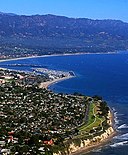
File:Aerial-SantaBarbaraCA10-28-08.jpg
外观
Aerial-SantaBarbaraCA10-28-08.jpg (550 × 387像素,文件大小:74 KB,MIME类型:image/jpeg)
文件历史
点击某个日期/时间查看对应时刻的文件。
| 日期/时间 | 缩略图 | 大小 | 用户 | 备注 | |
|---|---|---|---|---|---|
| 当前 | 2009年1月29日 (四) 02:22 |  | 550 × 387(74 KB) | Jw4nvc | == Summary == Aerial photo of Santa Barbara, California (USA) taken 1pm 10/28/08 from about 350m altitude looking toward the Northeast. In the foreground is Shoreline Park and the edge of The Mesa neighborhood. Just beyond is Ledbetter Beach and SBCC. The |
| 2009年1月2日 (五) 08:51 |  | 550 × 625(119 KB) | Jw4nvc | Aerial photo of Santa Barbara, California (USA) taken 1pm 10/28/08 from about 350m altitude looking toward the Northeast. In the foreground is Shoreline Park and the edge of The Mesa neighborhood. Just beyond is Ledbetter Beach and SBCC. The harbor is nex |
文件用途
没有页面使用本文件。
全域文件用途
以下其他wiki使用此文件:
- af.wikipedia.org上的用途
- ang.wikipedia.org上的用途
- an.wikipedia.org上的用途
- ar.wikipedia.org上的用途
- arz.wikipedia.org上的用途
- azb.wikipedia.org上的用途
- az.wikipedia.org上的用途
- be.wikipedia.org上的用途
- ca.wikipedia.org上的用途
- ceb.wikipedia.org上的用途
- ce.wikipedia.org上的用途
- crh.wikipedia.org上的用途
- cy.wikipedia.org上的用途
- dag.wikipedia.org上的用途
- da.wikipedia.org上的用途
- de.wikipedia.org上的用途
- de.wikivoyage.org上的用途
- el.wikipedia.org上的用途
- en.wikipedia.org上的用途
- en.wikivoyage.org上的用途
- eo.wikipedia.org上的用途
- es.wikipedia.org上的用途
- et.wikipedia.org上的用途
- eu.wikipedia.org上的用途
- fa.wikipedia.org上的用途
查看此文件的更多全域用途。


